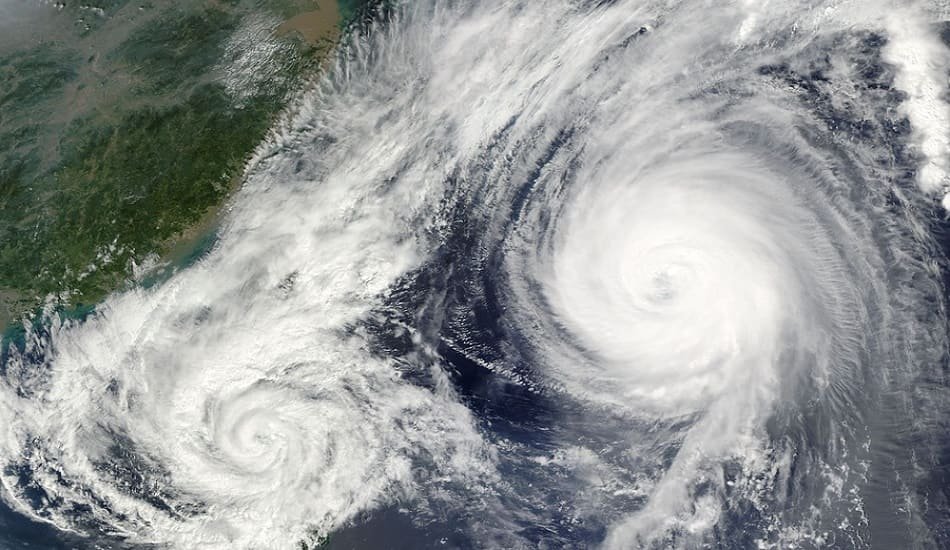
IMD is keeping a careful eye on cyclonic circulation over the North Andaman Sea.
In the run-up to the much-anticipated North-East monsoon (NEM), the India Meteorological Department (IMD) is keeping a careful eye on cyclonic circulation over the North Andaman Sea. During the next 3-4 days, the system is expected to move approximately westward (towards the Tamil Nadu-Andhra Pradesh coast).
The IMD has not specified the projected amount of intensification or the most likely point of landfall. The sea surface temperature in the South Bay of Bengal is slightly beyond the threshold for system expansion, but it is warmer in the Central Bay and farther north, which is optimal for intensification. These, combined with any approaching western disturbance heading eastward across North-West India, might potentially dictate the system’s trajectory.
Also Read | IMD, Japan & UNDP have unveiled new project to expedite climate action in India
Awaiting the IMD outlook
The IMD is anticipated to release its NEM prognosis soon. It is currently keeping an eye on the withdrawal line of the preceding South-West monsoon, which has been stopped over the past week. M Rajeevan (@rajeevan61), renowned monsoon specialist and former Secretary of the Ministry of Earth Sciences, tweeted on Wednesday: ‘Monsoon Update: South-West monsoon will now fast leave from the country in the next 7-10 days.’ The North-East monsoon and cyclones should therefore be prioritised. Early indicators indicate that conditions are improving for the commencement of NEM by October 20.’ Rajeevan has tagged both the IMD (@Indiametdept) and the Ministry of External Affairs (@moesgoi) in his tweet.
A reference to cyclones
The reference to ‘cyclones’ in Rajeevan’s may not be wholly out of context, considering that both the South-West to North-East monsoon transition period and the North-East monsoon are known to host powerful weather systems in the Bay. Some meteorological models predict that Wednesday’s cyclonic circulation over the North Andaman Sea will gradually gather traction and power during the following week. Meanwhile, the IMD has forecast fairly widespread to widespread light to moderate rainfall with isolated heavy falls, thunderstorms, and lightning over Tamil Nadu, Puducherry, and Rayalaseema for the next four days; over South Interior Karnataka on Wednesday, Saturday, and Sunday; over Coastal Andhra Pradesh on Thursday and Friday; and over Kerala and Mahe on Saturday and Sunday.
Weather forecasters
The circulation over the North Andaman Sea is expected to become buried in an East-West trough (over the Bay) and proceed westward towards the beaches of North Tamil Nadu and South Andhra Pradesh, according to weather expert @Selwyyyn. It is expected to rain heavily from Friday to Monday. Separately, two other Twitter accounts were cautiously enthusiastic about the Bay’s changing fortunes.
Also Read | IMD anticipates that India will experience moderate monsoon rains in 2022
‘As we gradually reach the NEM season, loads of noise from model outputs are already signalling a potential system around October third week,’ remarked @jhrishi2. As always, a lot of factors will play a big part in such systems, which are far too early to discuss.’ @caregroupjoseph mentioned a lot of twists and turns in determining a likely onset date. The potential onset dates are October 19-22 and October 29-November 2. (more likelier of the two). @chennai13621472 also predicted the commencement between October 21 and 28 and October 28-November 4.


Add Comment